3D Map Overlays Now Available at Boondocker's Bible
You can now view a 3D map similar to Google Earth, but with public land overlays for BLM, USFS, NPS, and NWR land, all for free.
Many boondockers use Google Earth when exploring potential boondocking sites because they can see the topography of the land. However, Google Earth won’t show you where the public land boundaries are.
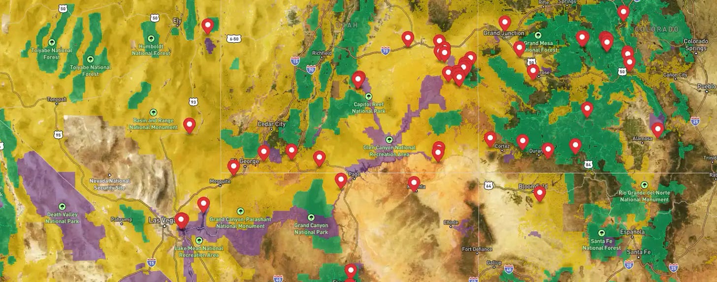
So, we launched a new 3D boondocking map similar to Google Earth, but with public land overlays. Now you can see where federal lands are, and the topography too…
https://www.boondockersbible.com/map/
It’s free to use, no signups required.
Yellow = BLM land
Green = US Forest Service land
Purple = National Park Service land
Red Marker = popular boondocking places
How to Use the 3D Controls
When viewing the map, click on the “3D” button to see mountains and canyons in full 3D relief.
On a PC, hold down the CTRL key and the Left Mouse button to tilt and rotate the map. Use the mouse wheel to zoom in and out.
On a mobile device, you can rotate and tilt the map by touching the screen with your thumb and index finger at the same time, and twisting your fingers left and right.
There is also a button to view the map in full screen.
You can watch a brief video demonstration here.
What Are Public Land Overlays Good For?
They’re good for knowing where all the free camping is!
Both the BLM and USFS allow free camping on the vast majority of its lands. As long as you are inside their boundaries, you are generally good to camp anywhere you want. There are, of course, exceptions, and you should visit the BLM website and USFS website to find out which areas are currently closed for camping.
To find a free place to camp, zoom in on a yellow or green shaded area…
Then look for dirt roads and follow them until you see what appears to be a previously-used campsite, usually identified by a cleared-off area or a small road-loop.
You can then find the same place on Google Maps to set a marker and use its driving directions to get there.
What About the National Park Service?
Most national parks do not allow boondocking (there are few exceptions), however the National Park Service (NPS) does allow boondocking in many of its national recreation areas and national monuments.
The reason for adding the purple-shaded NPS overlay in the map is to show you where all of the NPS properties are located because most boondockers want to camp close to these areas.
What are the Rules for Camping on BLM and USFS Lands?
Both the BLM and USFS each have their own sets of national rules. But each BLM state office and field office can also adopt additional rules. The same is true with each national forest and each ranger district.
For the most part, the general rules are as follows…
Bureau of Land Management
14-day stay within a 30-day period, within a 25-mile radius. The details of this can get complicated, but it’s discussed in an article entitled, “The BLM 14-day Rule Explained”.
The only places you cannot set up camp (for free) are: day use areas, picnic areas, boat ramps, trail heads, viewing areas, visitor centers, and paid campgrounds. Everywhere else is pretty much open to camping. Details are explained here, “Is it Legal to Camp Anywhere on BLM Land?”
Your vehicle must remain on established roads and trails. Even though camping is allowed on nearly all BLM land, you can’t drive your vehicle off the road. You must park only on previously-used clearings and campsites. Read more about this at, “Can I Drive My RV Off-Road on BLM Land?”
You can read more BLM camping rules at, “Boondocking on BLM Land”.
U.S. Forest Service
14-day stay is the general rule for most national forests and grasslands. A few forests go as high as 28 days, and some go as low as 5-days. Many forests vary with respect to how long you must wait before returning to the same area. You can see the occupancy rules for every forest and grassland at, “How Long Can You Camp in a National Forest?”
The USFS gets more restrictive than the BLM in terms of blocking off certain areas from camping. Each forest will publish a “forest order” which announces these closures. You’ll have to visit the USFS Website, then drill down to a specific state, then forest, and then click on, “Alerts and Closures”.
The USFS is also more restrictive on where you can drive your vehicle. Each forest publishes a “Motor Vehicle Use Map” which illustrates which roads are limited to street-legal vehicles, and which are open to off-road vehicles. These maps will also tell you the maximum distance off the road your vehicle can travel. Learn more about this at, “How to Use Motor Vehicle Use Maps to Find Free Camping”.
You can read more USFS camping rules at, “Boondocking in National Forests”.
Boondocking Sites of the Week
[See our Boondocking Map for more sites]
Gunsight Wash, BLM, Ajo, AZ, (GPS: 32.2360, -112.7584) - Located in the southern part of Arizona, you’ll stay warm during the winter while the rest of the country freezes. This area is also close to Organ Pipe National Monument and Cabeza Prieta NWR. The tiny town of Ajo offers groceries and dining as well as the “largest hole in the United States”. Learn more about this site.
Government Wash, NPS, Lake Mead, NV, (GPS: 36.1235, -114.8316) - Located inside Lake Mead NRA, this “undesignated” dispersed camping area is popular with boondockers because it offers some of the closest free camping to Las Vegas, NV. You’ll need to have an Interagency Pass otherwise it’ll cost you $25.00 each time you enter the NRA. But, you can purchase a pass at the gate. Read more about this site.
Sidewinder Road, BLM, Ogilby, CA, (GPS: 32.8173, -114.7948) - At just 15-30 minutes from Yuma, AZ, this large expanse of BLM land hosts hundreds of snow-birding boondockers each winter. You can refill with potable water at nearby Sand Hills Rest Area, and dump your tanks at nearby Chevron fuel station. Learn more about this site.
Can You Camp on Wilderness Lands?
Yes, you can camp on lands designated as “wilderness”, you just can’t drive your vehicle in.
The word “wilderness” was turned into a legal term with the Wilderness Act of 1964. That piece of legislation allowed federal agencies to identify tracts of pristine land and submit them for protection under the Act. Each application has to be approved by Congress.
Once approved as wilderness, no one can operate a vehicle of any kind on such land, and that includes human-powered vehicles like bicycles, kayaks, or even a wheelbarrow. All transportation must be by foot, horse, or pack animal. You can still camp in wilderness; you just have to hike it in.
But even tent camping on wilderness comes with limitations. You cannot operate any kind of machinery, whether mechanical or electronic. Technically, that includes cellphones and cameras, though law enforcement officers typically don’t cite people for small stuff. It’s mostly larger items like a propane cooking grill, a propane heater, or a battery-powered fan that can get you into trouble. Your Jackery solar-powered generator is also banned.
The concept behind wilderness is that human beings should be “observers” only and not become an integral part of that land. In fact, the Wilderness Act of 1964 defines wilderness as…
A wilderness, in contrast with those areas where man and his works dominate the landscape, is hereby recognized as an area where the earth and its community of life are untrammeled by man, where man himself is a visitor who does not remain.
Some Wilderness Areas Have Roads and Parking Lots
Actually, the roads and parking lots are not technically within the boundaries of a wilderness. In all cases, a road or parking lot can get to about 50 feet from a wilderness boundary, but never cross in.
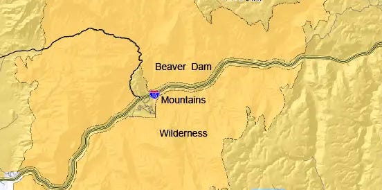
A road can cut through a wilderness by simply diving a wilderness into two halves, and then carve out a 100-foot channel in between…

Hence, as long as you remain on a road, you will never “accidentally” drive on to wilderness.


