


How to Find Boondocking Sites Using Map Overlays
Learn how expert boondockers find free campsites using BLM and USFS map overlays.

While many digital nomads use websites like Campendium and iOverlander to read reviews of popular boondocking sites, expert boondockers prefer to use satellite maps and map overlays to find undocumented campsites.
What Are Map Overlays?
These are colored, semi-transparent areas laid over a map representing public lands…

(Yellow) BLM lands
(Purple) National Park Service lands
(Green) US Forest Service lands
How to Find Free Campsites Using Map Overlays
To discover places where you can drive your vehicle and set up camp for free…
Open the Boondocking Map by going to: https://www.boondockersbible.com/map/
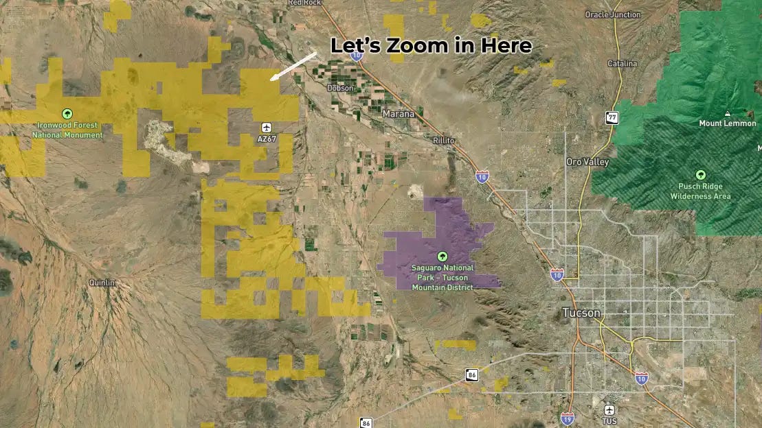
Pick an area where you want to camp (for example, Tucson, AZ)
Zoom in on a Yellow or Green area. (Purple and Orange areas have more restrictions, and require more in-depth knowledge of those lands)
Now look for a road leading into that area and follow it until you find a previously-used campsite, or previously-used clearing.
As long you remain in a yellow or green overlay, you’re generally safe to camp there, unless you see signs prohibiting camping.
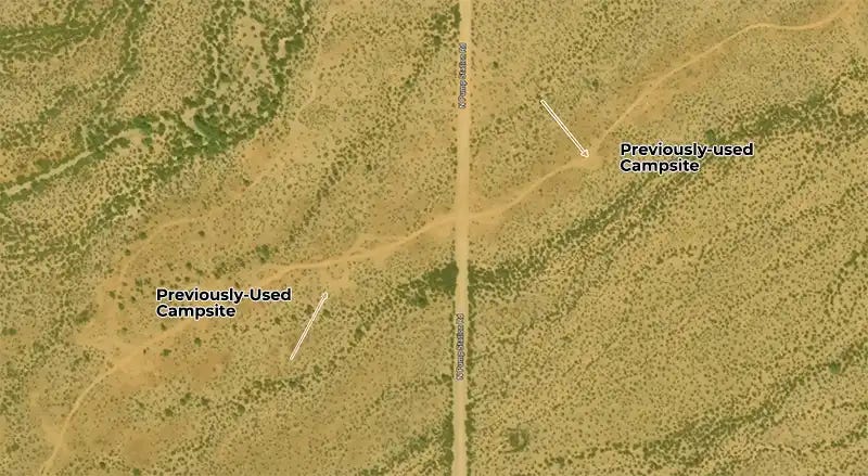
Once you have found a previously-used campsite or clearing, drive there and set up camp.
How to Use 3D Controls with the Map
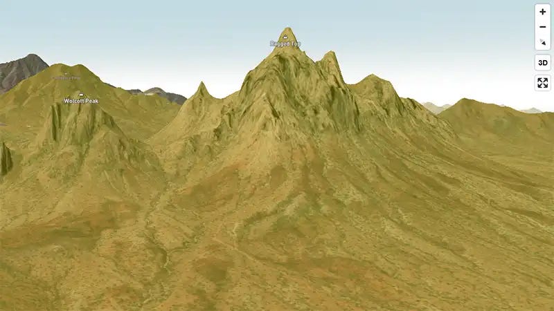
The Boondocking Map offers the ability to see the terrain in 3D relief….
Click on the “3D” button on the upper-right of the map.
Hold down the <CTRL> key and the left-mouse button at the same time, and then move your mouse left, right, up, and down, to tilt and rotate the map.
On cellphones and tablets, hold down two fingertips on the glass, and turn fingertips to tilt and rotate the map.

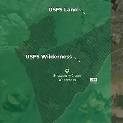
How to Identify Wilderness areas on a Boondocking Map
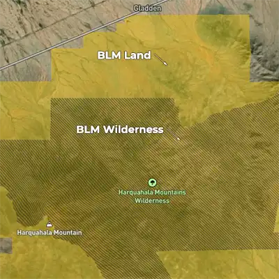
The above map also depicts wilderness areas. Wilderness is a legal term defined in the Wilderness Act of 1964. It identifies lands owned by the federal government that have no improvements of any kind, including roads, campgrounds, or fire lanes, and no infrastructure, including underground water pipes, electrical lines, etc.
Only U.S. Congress can declare an area of land as wilderness. Camping is still allowed on wilderness, but you have to carry in your camping gear by foot, horseback, or pack animal.
Wilderness areas are identified in the Boondocking Map (https://www.boondockersbible.com/map/) with diagonal shaded lines…
Boondocking Sites of the Week
[See our Boondocking Map for more sites]
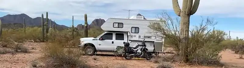
Silverbell Road BLM, Avra Valley, AZ, (GPS: 32.4558, -111.4438), Located inside Ironwood Forest National Monument, this area is located about 30-minutes west of Tucson, AZ. It’s known for its Mesquite trees (Ironwood) and Saguaro Cactus, and it’s popular with boondockers during the Winter season. Learn more about this site on YouTube.
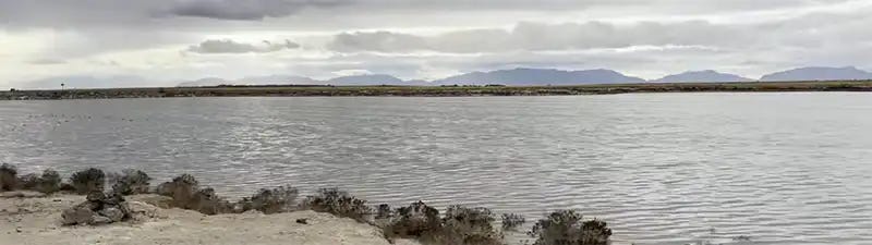
Holloman Lake, White Sands, NM, (GPS: 32.8103, -106.1220), One of the few public campgrounds operated by the Department of Defense, this area is popular with campers seeking something close to White Sands National Park. The only knock on this place is that people tend to leave a lot of trash laying around. Learn more about this site on YouTube.

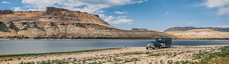
Chief Mountain South Campground, Caliente, NV, (GPS: 37.6044, -114.6592), Operated by the BLM, this is a developed campground offered for free. It serves as the launch point for Silver State OHV trail and is popular with weekenders with quads, side-by-sides, and dirt bikes. The town of Caliente is nearby for supplies. Read more about this campground.
Is It Required to Camp a Minimum of 200 Feet Away from Water?
No, it’s not required.
The BLM, USFS, NPS, USFWS, etc., etc., will often recommend you set up camp at least 200 feet away from a body of water, including lakes, ponds, rivers, and streams. However, they don’t require it.
The “200 feet” rule was created in the 1990s, when the Leave No Trace Center for Outdoor Ethics, the actual non-profit organization stewarding the “Leave No Trace” movement, adopted its “Seven Principles”. These principles serve as a suggestion to outdoor enthusiasts on how they should behave with respect to the environment. The 200 feet rule is part of the Seven Principles.
The idea behind the 200 feet rule is…
To prevent spillage of food, detergents, and other man-made materials from accidentally entering water bodies.
To prevent urine and feces from entering water bodies.
To provide enough safe space for wildlife to drink from water bodies.
Federal and state land management agencies have entered into agreements with Leave No Trace to support the Seven Principles, which is why you’ll see these agencies recommending them. But they remain as just recommendations.
There are Exceptions, However
These federal and state agencies will adopt special rules for special places. White River National Forest in Colorado adopted the following rule about dispersed camping within its Dillon Ranger District…
It is generally allowed anywhere except within 100 feet of a lake, trail, or stream, or where posted as closed.
Which is why it’s important to look over the rules of each BLM state agency or national forest, just to be sure.
Some States Have Their Own Water Setback Rules
Arizona is the most well-known. The Grand Canyon State has a law on the books that prohibits camping within 1/4 mile from a natural waterbody or a livestock watering container…
It is unlawful for a person to camp within one-fourth mile of a natural water hole containing water or a man-made watering facility containing water in such a place that wildlife or domestic stock will be denied access to the only reasonably available water.
Note that the law says, “…in such a place that wildlife or domestic stock will be denied access…” Thus, make sure you have not denied access to that watering container or waterbody, and technically you’ll be legal even if you’re camped within a 1/4 mile.
This law also applies to federal lands within Arizona. Although interestingly, the National Park Service is the only federal land management agency that has declared state and local laws do not apply to them (which is a discussion for a future newsletter).